Posts

Day 6

Image
 July 13 Locations: Glaze Meadow, Metolius Basin, Wizard Falls Hatchery   We met up with Alex at the Sisters Ranger Station in the Deschutes National Forest. He has been working in the Deschutes for 12 years, his background is in fire management which he did for 20 years and he has worked for the federal government around 24 years. Currently his work is in Managing Partnership Programs, working with the local tribes who are willing to get involved with the work they are doing, non-profit organizations and volunteer groups. Lauren, the Environmental Coordinator, works with the NEPA process, interdisciplinary teams, and public engagement. She explained that most of the work she does with NEPA is in the lower two categories. John was our Wildlife Biologist tour guide through Glaze Meadow. Ian is the District Manager for the Sisters Ranger Station, and Andrew, the Fire Management Officer, joined us at the Metolius Basin. Finally, we met Rain who works at the Fishery. Glaze M...

Day 7

Image
 July 14 Location: The Big Obsidian Flow   This morning we did our analysis under the microscope and collected more data from the Upper Deschutes River. We also worked together on our field notes and made sure we all had the data we have collected and organized it systematically. We went to the Big Obsidian Flow and did the 3/4 mile hike.  Photographed: View of the Big Obsidian Flow Microscope Analysis: Strawberry Lake Gram Observations I noted for my slide were: -           Purple stain o    Eggs, circular shapes, with clear center o    Vein like stains, some short some longer than others o    Empty pockets where no staining or bacteria is present (minimal and small areas) Field Journal: Site 1 -           Strawberry Lake location Date: July 9 th , 2023 Time: 2:00 pm Coordinates: 44.3068 Degrees North, 118.6852 Degrees West E...

Day 5

Image
 July 12 Location: New Bend Ford Rock District (Sand Spring Area)   We did some work today helping with rare plant monitoring. Botrychium Pumicola or Pumice Moonwort, which is endemic to Oregon and can only being found in certain locations, one of them being Mt. Shasta in California. Since its discovery the plant has been dwindling in population. It grows in the riparian forest which tells us some things about the plant, it requires fast draining soil and light rainfall. We gave ourselves 6-10ft of space between each other and did our best to follow our transect lines to help mark where we found the plant. I did not find any. I was not able to participate with the rest of the group as much today. Pictured: Botrychium Pumicola Pictured: Environment of Site Surveyed

Day 4

Image
July 11 Location: OSU Geological Field Station   Today was our last day at the OSU campsite. We finished our bacterial analysis from the water samples we took and took some measurements of Keyes Creek. They came out vastly different just from the placement of the camera. We travelled to Deschutes Bridge campground; it is a U.S. Forest Service campground that is closed for the public but we are allowed to come up here.   Keyes Creek at OSU Geological Field Station Water Analysis: Canopy Cover Data: Device Name (CI 110 Plant Canopy Imagery)   I held the camera higher up from the water and the measurements we recorded were: PAR AVG 53 Gap Fraction LAI 0.8 Leaf Angle 0.1 Sun flecks 0% PAR LEI 3.4 Canopy Density 55.2%   Zach took measurements as well but held the camera closer to the water. PAR AVG 823 ...

Day 3

Image
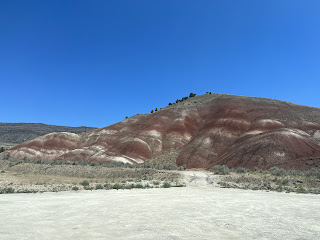
 July 10 Locations: Meyers Canyon to the Narrows, Painted Hills, Hudspeth Mudstone   Our trip today had Dr. Brennan Van Alderwerelt as our tour guide from the University of Oregon. His undergrad years were at University of California in Davis where he graduated in 2010 with a degree in Astrophysics and later received his Doctorate in Geoscience with a focus on Geology/Petrology in 2012 with the University of Iowa. He has been doing work for 10 years and his interest in geology and the environment began when he worked for the Department of Water and witnessed just how poorly water is treated. Where we began was South of Meyers Canyon and due to the number of fossils found in the area it is believed to be where dogs originated from. The only dinosaur fossil that has been found in Oregon was in this area. There is sediment from the Cretaceous period at this site but the further we went into the area the time stamps differ; those being the Permian, Tertiary, and Cretaceous. ...

Day 2

Image
 July 9th Location: Strawberry Lake                 This morning we got up at 6:00 am to start the day. We had breakfast at 7 and left an hour later. The drive to the lake was 2 hours away from where our campsite is located. Unfortunately, I was not able to complete the entire hike like I had hoped but enjoyed my day exploring the area. We noticed at the location that there was a large quantity of dead trees, both standing and some that had fallen over. My group during the hike decided to spend most of our day by Strawberry Lake but tried to visit Basin Lake before finding out it was another 3-miles away and turning around. Today was a great reminder that I need to take more pictures at the areas I visit. I also learned about the Basalt found in the area which is a different type then the ones we see over in Central Washington. I was told that the Basalt found there is Oceanic Basalt. Dr. Black and I were abl...

Day 1

July 8 - Arrived at Heritage campus around 10:00 am  - Helped with cleaning dishes  - Registered for classes   Location: Mitchell, Oregon   I have never been camping before so this is an entirely new experience for me. During our drive here we saw a cliffside that had beautiful shades of green throughout it. I learned how to set up a tent today… with some extra help of course. I had a good day talking to new people and sharing stories with them. Looking forward to our hike tomorrow at Strawberry Lake, which is a 7-mile hike round-trip and I am planning on doing the whole trail if I can.